
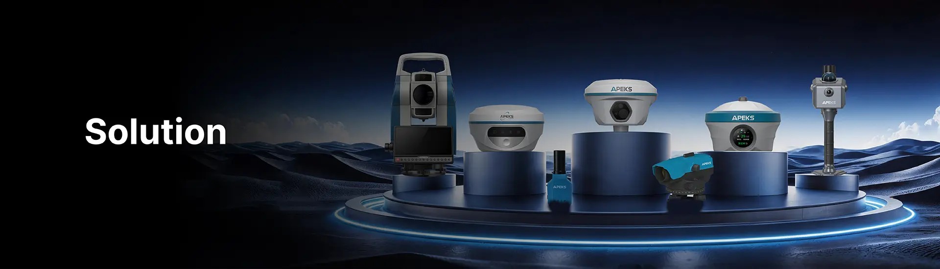
Modern topographic mapping demands equipment that handles open desert corridors, forested mountain terrain, and dense urban cores in the same project week. The right instrument depends on terrain, obstruction level, and correction infrastructure — not a single product. APEKS provides a complete RTK ecosystem: first-generation dual-purpose base/rover units, second-generation receivers with integrated laser and vision capabilities, a dedicated long-range base station, and a lightweight handheld — all running ApekSurv field software on the same project file.
The Core Challenges in Topographic Survey
Cause: Standard RTK receivers require the pole to be plumb within a degree for accurate measurement — the operator must stop, check, and level at every point. On uneven terrain this adds 5–10 seconds per point, accumulating to hours on a thousand-point survey.
Fix: APEKS receivers use a 120° calibration-free IMU with no magnetic calibration required. The operator plants the pole tip and records immediately at any angle up to 60° from vertical — no levelling step, no calibration reset. All models from AP10 to AP80 Pro carry this IMU as standard.
Cause: RTK requires a minimum number of satellites across multiple constellations to resolve carrier-phase ambiguities. Under dense canopy or surrounded by tall buildings, usable satellite count drops below the threshold for consistent Fixed solution.
Fix: All APEKS receivers track 1408 channels across 7 constellations simultaneously — GPS, GLONASS, BeiDou, Galileo, QZSS, NavIC, SBAS. Full-constellation tracking maximises the usable satellite pool in any obstruction scenario. For points beyond GNSS reach, the AP40 Laser+ measures inaccessible features by laser from a clear vantage point — wall faces, embankment slopes, and features across drainage channels — without a second instrument setup.
Cause: RTK accuracy degrades with baseline length. Beyond 50 km, atmospheric decorrelation prevents reliable Fixed. Beyond 70 km, Fixed resolution is unreliable regardless of receiver quality.
Fix: Deploy APEKS Base+Rover 1+1. Any AP10 or AP20 serves as a lightweight base on a known control point, broadcasting via built-in 2W UHF radio to the rover within 8–15 km. For large project areas, deploy the MAX5 dedicated base station — 5W LoRa radio, 25 km range, 13,200 mAh battery for 8+ hours of continuous operation. No internet, no cellular dependency, no CORS subscription required.
APEKS Solution for Topographic Mapping
OPEN-TERRAIN PICKUP:
AP20 rover or any 2nd Gen receiver with MAX5 base station or CORS connection. 120° IMU single-operator pickup. ApekSurv records point codes, descriptions, and solution quality for every observation — office-ready data from the field. APS1 handheld supports lightweight GIS attribute collection alongside the main topo survey.
MIXED AND OBSTRUCTED TERRAIN:
Full-constellation 1408-channel tracking extends Fixed into light-to-moderate canopy. For inaccessible features — embankment slopes, features across drainage channels, building façades — the AP40 Laser+ measures by laser offset from a clear standpoint up to 120 metres away, without moving the instrument setup.
For inaccessible or hazardous features — live power lines, unstable slopes, or areas with no safe foot access — the AP60 Vision and AP80 Pro support visual measurement via the front-facing camera. The operator shoots a video sweep of the target area; the software automatically extracts stereo photo pairs and derives 3D absolute coordinates for each matched point. The resulting coordinate data carries full 3D positional information and can be imported directly into 3D modelling software. This also complements drone survey — covering blind spots and corners that aerial imagery cannot reach, with data from both sources combined into a single 3D model.
REMOTE SITES:
MAX5 base station on a known control monument. 5W LoRa covers up to 25 km across flat terrain from one base position. 13,200 mAh battery runs a full 8-hour session without external power. Multiple rovers can work simultaneously from the same MAX5 base.
Recommended Equipment for Topographic Survey
| Instrument | Generation | Key Specification | Best For |
|---|---|---|---|
| AP10 | 1st Gen Rover/Base | 1408ch, 120° IMU, 2W UHF, IP67/IK08 | Entry rover, lightweight base for remote sites |
| AP20 | 1st Gen Rover/Base | 1408ch, 120° IMU, 2W UHF, IP67/IK08 | General rover, base+rover kits, developing markets |
| AP30 Laser | 2nd Gen Laser | 1408ch, 30m laser, front: laser aiming, bottom: AR stakeout | Urban topo, short offset measurement |
| AP40 Laser+ | 2nd Gen Laser | 1408ch, 120m laser, front: laser aiming, bottom: AR stakeout | Infrastructure, slope faces, inaccessible features |
| AP50 Vision | 2nd Gen Vision | 1408ch, front: visual survey+3D, bottom: AR stakeout | 3D modelling alongside topo pickup |
| AP60 Vision | 2nd Gen Vision | 1408ch, front: visual survey+3D, bottom: AR stakeout | High-volume sites, visual measurement |
| AP80 Pro | 2nd Gen Flagship | 1408ch, 120m laser, front: laser+visual, bottom: AR stakeout | All terrain, ALL IN ONE |
| MAX5 | Dedicated Base | 5W LoRa, 25km, 13200mAh, OLED, no controller | Remote base, desert, offshore, large area |
| APS1 | Handheld RTK | 1408ch, 60° IMU, 210g, IP67 | GIS collection, asset inventory, light topo support |
All instruments run ApekSurv field software. GNSS data from all models is recorded in a single project file format — no post-session conversion or dataset merge required.
COMPLETE RTK ECOSYSTEM. ONE SOFTWARE PLATFORM.
From entry base/rover to flagship all-in-one — APEKS covers every topographic scenario with 1408-channel full-constellation GNSS and 120° calibration-free IMU across the full range.
View APEKS GNSS Receivers →